
DAY HIKES CLOSE TO BOGOTÁ
“If Earth’s biodiversity were a country, it could be called Colombia.”
Bogotá, Colombia’s capital city, is a sprawling metropolis that millions of people call home. Situated on a high plateau in the Altiplano Cundiboyacense region of the Andes mountain range, the average altitude is an eyewatering 2,600 metres/8,530 feet.
Bogotá is surrounded by cerros easily exceeding 3,000 metres/9,843 feet and is the perfect base for numerous weekend and day hikes where you can experience unique fauna and ecosystems of the Colombian high Andes, which are not found anywhere else in the world.
Here are some tips to avoid altitude sickness while hiking in Colombia:
Take time to acclimate on arrival, especially while hiking or undertaking any strenuous activity in the city. It can take several days to adapt to a new altitude.
- Avoid alcohol:
Alcohol is a blood thinner and will increase the symptoms of altitude sickness. - Stay hydrated:
Not only will this help you to avoid altitude sickness but it will also assist in easing the symptoms. - Eat meals packed with iron and carbohydrates:
Not a difficult thing to do in the country of parrilla (BBQ) and fabulous bakeries. - If you know you are especially sensitive to altitude you can be prescribed medication by your doctor to help prevent altitude sickness.
- There are many day hikes that are easily reachable from Bogotá, some even start in the city itself and you can just walk up straight up into the cerros. Others are a short journey from one of Bogotá’s bus terminals or by car.
The main problem with leaving the city is traffic and the slow bus system. Do make sure you leave early and if taking public transport, which is recommended, take a taxi or Uber to the bus terminal. They tend to be cheap and the extra cost will save you the nightmare of crossing the city using the Trans Milenio. - Colombia is a wild, exotic, beautiful and thrilling country full of raw natural beauty and an exciting culture and hiking around the sensational scenery is one of the finest ways to see it all.
- With a wide arrange of truly gorgeous and stunning scenery, from the lush, green forests to beautiful beaches all the way to majestic and massive mountains and volcanoes.
Hiking is one of the best ways to discover the natural delights and massive biodiversity of the country and the intoxicating, fun and amazing culture of the country will make you want to explore even more.
LA CHORRERA WATERFALL
 We work with and recommend booking flights with www.kiwi.com
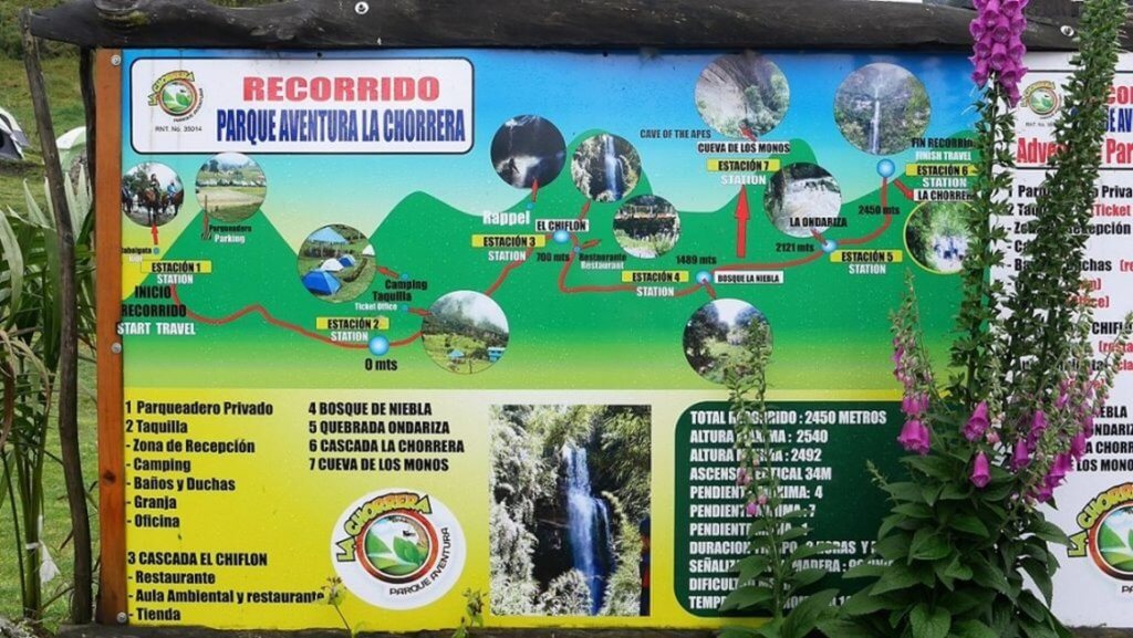
This is the prime day hike within striking distance of Bogotá and a 6.4 km/4 miles round trip covering the best part of 3 hours. The route to La Chorrera Waterfall follows a stretch of the Camino Real, built during the period of Spanish colonization to provide a direct route linking Bogotá and the city of Villavicencio, some 100 km/62 miles south. This ambling, but easy to follow path is shrouded by a dense expanse of cloud forest, thick with bromeliads and the chirping of birdsong.
A magnificent bounty lies at the conclusion of the hike: At 590 metres/1,935 feet, La Chorrera is Colombia’s highest waterfall, with seven spouts spilling furiously over a limestone escarpment veiled in moss and lichen, then crashing into a glassy pool.
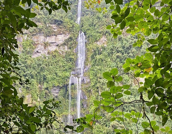
While the trek is not particularly strenuous, you will need to spend a couple of days acclimatizing in Bogotá beforehand to prepare yourself for the altitude of over 2,400m/7,874 feet.
You should also pack a waterproof coat and be fully prepared to get wet as the waterfall is often shrouded with clouds that periodically deposit frequent cool rain onto the misty vegetation below.
CHINGAZA
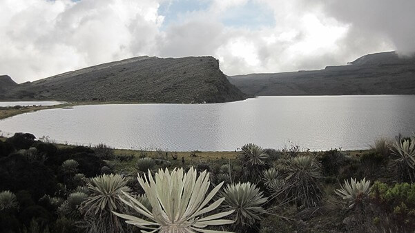
Chingaza Natural Park is one of the favourite destinations for those who enjoy an authentic connection with nature. It is very fortunate for it to be so close to the city, and there are various trails from different entrances. The park is remote and heavily regulated, only allowing a limited number of hikers per day.
The hauntingly majestic Chingaza Natural Park is truly unspoiled and carpeted with frailejónes, a highly adapted plant that only grows in páramos. Chingaza is a territory composed of páramo and high Andean forest, inhabited by countless species of fauna and flora. The plants capture moisture from passing clouds with their spongy trunks and release the water into the soil, creating mountain lakes and underground reservoirs, which eventually become rivers. The wetlands of Chingaza provide nearly all of Bogotá’s water supply.
Chingaza has several trails that cut through its very soggy marshland. Arm yourself with proper waterproof footwear. For a stunning bird’s eye view of the Siecha lagoons, the 7 km/4.4 mile trek to the Cuchillas de Siecha escarpment will, quite literally, take your breath away. You might be lucky and observe an Andean bear while breathing in the rarefied view of beautiful lagoons in this spectacular reserve.
With altitudes of 3,300 m/10,837 feet and higher, hiking in Chingaza and indeed all páramos needs to be approached with patience and caution. Check the Colombian National Parks website www.parquesnacionales.gov.co for more information, or book a trip with BnB Colombia Tours.
SUMAPAZ
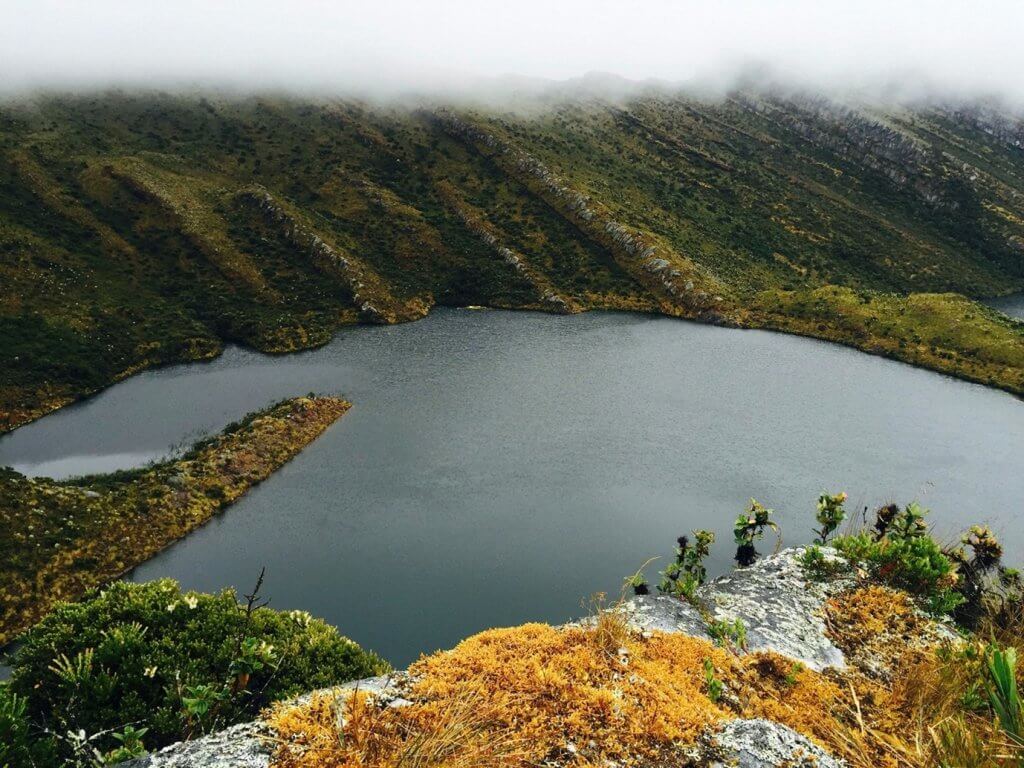
Once sacred territory of the Muisca Indigenous tribe, the incredible páramo, the largest in the world, extends for an astonishing 1,420 sq km/548 square miles.
 Lake Chisacá, Sumapaz National Natural Park
Nowadays, one is fortunate to be able to hike this territory, as for many years was not accessible due to the Colombian internal conflict. It is home to a diverse number of species, including the endangered Andean spectacled bear and Andean condor.
The most accessible trail takes you past fields of fascinating frailejónes, reaching Cuchillas de Bocagrande, a long rock formation that interrupts the otherwise rolling wetlands. Depending on the weather conditions and your level of acclimatization, it is possible to climb up to a 4,000 m/13,123 feet panoramic viewpoint.
Sunscreen and rain protective gear are essential as the territory is marshland, and the weather can change in an instant. Since it is difficult to access and easy enough to get lost in the mist, it is best to have BnB Colombia Tours arrange the hike for you.
LAGUNA de IGUANQUE
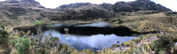 Laguna de Iguaque
The 4 km/2 ½ mile trek to the misty Laguna de Iguaque, located at 3,700m/12,140 feet in the Santuario de Flora y Fauna Iguaque, is an energizing, uphill adventure.
The trail traverses various ecosystems and microclimates, finally summiting at a serene landscape that, according to Muisca folklore, was the origin of humanity and a sacred pilgrimage site. Traditionally, as Muiscas made the journey up the mountain, they would collect bad thoughts into an imaginary pouch and then throw it into the lagoon to rid themselves of negative energy.
Do not let the sparse vegetation fool you into thinking you are alone. Through the mist, you may observe birds, squirrels, wild rabbits, armadillos, foxes, deer, or even the rare spectacled bear.
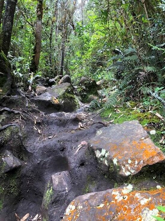 The trail
It is a good idea to stay the night at the base camp lodging before you hike to give yourself time to acclimatize.
MATARREDONDA ECOLOGICAL PARK
 Begin organizing your dream Colombian getaway right away by using our Plan My Trip page!
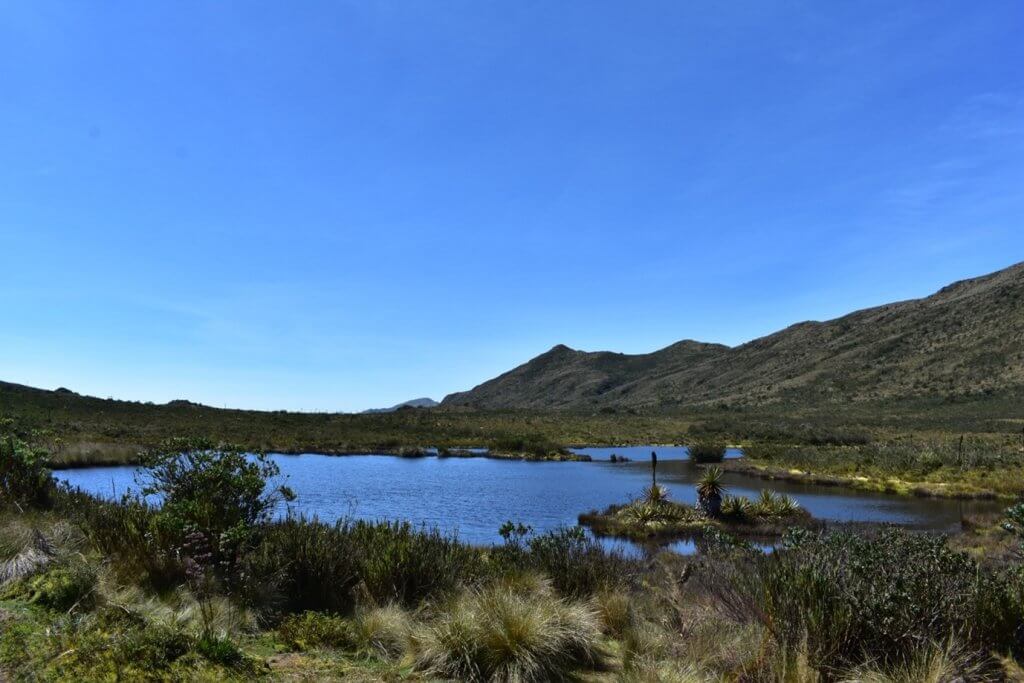
The Matarredonda Ecological Park is just 18 km/11 miles from Bogotá and forms part of the Cruz Verde páramo, a complex of over 14 páramos that extend for 3,300 sq km/1,274 square miles.
To get there, take a bus heading for Choachí from the South Transport Terminal and advise the driver where you are going, and he will stop at the correct place. From the road, it is a 20-minute walk to the entrance. There are other routes, but it is advisable to go with a guide from Bnb Colombia Tours, as at times the weather can be very unpredictable, and it is easy to get lost.
The two main trails, one to the Cascada de la Abuela and the other to Laguna Verjón, are both well marked with little elevation change, and both can be completed in under 4 hours. The trail to the lagoon follows the Camino Real, a paved path set down by the Muiscas. Either remain at the deep lake to enjoy the vista or follow the trail for another 45 minutes to a summit called La Cuchilla.
On clear days, Bogotá and Cerro de Monserrate shimmer in the distance, framed by green mountains as far as the eye can see.
PÁRAMO LAS MOYAS
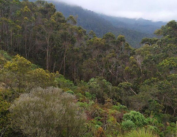
In the eastern hills of Bogotá, the closest páramo creeps over the edge of the city from 3,200 m/10,500 feet above. Dominated by huge boulders that were once part of a Muisca astronomical centre, the captivating scenery of Las Moyas exemplifies everything appealing about Colombia’s capital. One moment you are jostling through raucous, congested streets, and the next you are in pura naturaleza.
The 3 to 4-hour trek begins on the upper slopes of Rosales, at Calle 78 with Transversal 2a. The trail meanders through rich Andean forest, eventually opening up to a shrubby landscape with spectacular views of the city below.
Like to create or customize a fantastico package tour of Colombia? Use our Plan My Trip page to start planning your dream Colombian vacation now!