
BEST DAY HIKES IN AND AROUND MEDELLÍN
Sitting high in the Aburrá valley in the midst of the Andes, Medellín has an allure that, in recent years especially, attracts travellers in droves. For some time, the mere mention of its name brought memories of cartel inflicted terror but today, the vibe is serene and friendly. Nowadays this South American metropolis is deemed The City of Eternal Spring and is one of Colombia’s biggest attractions.
 The City of Medellín, with hiking in abundance
On a sunny day, Paisas mingle in public plazas and amid the callings of fruit vendors, mixing with salsa music flooding through open doorways. After heavy rain, clouds roll in level with the windows of hillside homes. The city is, after all, perched nearly 5,000 feet/1,524 m high.
That point alone should interest explorers with an affinity for hiking. Medellín is many things, but for those who prefer outdoor mountain environments, it is undoubtedly an interesting destination. The state of Antioquia, with its lush foliage, challenging terrain, and picturesque views, will not disappoint, and to top it off, the traditional hearty food will be just the thing to savour after trying any of these hikes.
In addition to the nightlife of El Poblado, the artwork of Botero and the funicular, many recommend heading to Guatapé to climb the steps of the 650 foot/198 m El Peñol, but the trails that snake through the mountains that surround Medellín are an underrated treasure and a richer experience. Luckily, there is a suitable hike for whatever fitness level.
CERRO BRAVO
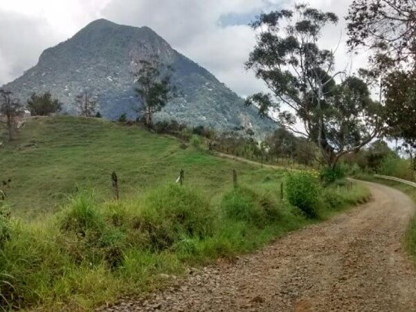
The lush Cerro Bravo is positioned between the two pueblos of Fredonia and Venecia. One advantageous facet of the Cerro Bravo day hike is that it provides the opportunity to see both of these charming pueblos.
Hikers can start in Venecia and finish in Fredonia, or indeed the reverse if so desired. Buses run from the Terminal del Sur bus station in Medellín and two hours later arrive in Parque Venecia.
The route towards the mountain starts close to the Parque, and to get pointed in the right direction, the friendly locals are happy to advise. Unlike many other hikes, the Cerro Bravo trail actually has some signage, so it is easy to confirm that you are headed in the right direction.
 We work with and recommend booking flights with www.kiwi.com
The lush Cerro Bravo is positioned between the two pueblos of Fredonia and Venecia. One advantageous facet of the Cerro Bravo day hike is that it provides the opportunity to see both of these charming pueblos. Hikers can start in Venecia and finish in Fredonia, or indeed the reverse if so desired.
Buses run from the Terminal del Sur bus station in Medellín and two hours later arrive in Parque Venecia. The route towards the mountain starts close to the Parque, and to get pointed in the right direction, the friendly locals are happy to advise. Unlike many other hikes, the Cerro Bravo trail actually has some signage, so it is easy to confirm that you are headed in the right direction.
CERRO QUITASOL
Locally known as the sun-removing mountain, Cerro Quitasol may have derived this moniker thanks to its giant stature that often blocks the sun for the residents of the city of Bello, at the very north end of the Aburrá Valley.
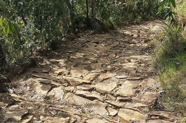 The trail
This hike has an advantage in that it can be accessed via the Metro system, rather than having a long travel time to arrive at the start. Take the metro to the end of the line going north and alight at Estación Niquia. From there, follow the signs inside the Niquia Metro Station that will point you in the right direction, and you will find a stair pathway that goes through various barios as it meanders up and out of the city.
The path continues up relentlessly, and by the end, you will have climbed over 1,200 metres/3,937 feet. Difficulty level for this hike is definitely on the high side, so be sure to be in adequate shape to attempt it. The view from the top is absolutely breathtaking and makes the uphill grind totally worth it.
After taking in the views for as long as you so desire, look for a different trailhead to the east to descend down. No good reason to return the same way that you made the ascent. There is a shaded route that weaves through some pine forests and has an ancient stone path, all of which combine to make it a more interesting descent. Eventually, you will find yourself back in Bello from whence you started. A tremendous day’s hiking.
ARENALES
 Trekking to the Arenales Waterfall
Located in the municipality of Envigado, Arenales is a beautiful natural area located high in the hills. To arrive, exit the Envigado Metro Station and look for one of the transit buses to Arenales, and before long, you will be twisting your way up the hills of Envigado. What is so welcome about going to Arenales is that the bus climbs much of the elevation for you, so by the time you get off the bus, the views are already spectacular.
Look for a sign to enter the nature area, and from there it is quite simple to follow the trails towards the waterfall. This hike is moderately challenging and will take two to four hours to complete. Hikers need to be aware that it is necessary to cross a river or two during the hike, making it a foregone conclusion that their feet will get soaked. During the rainy season, for much of the hike, it is a question of wading through thigh-deep waters to reach the end.
It is so worthwhile to endure a little discomfort, however, as the Chorro de la Campaña waterfall is just glorious and has the extra benefit of a small swimming area at its base.
EL SALADO
For a relaxing, easy hike then Parque El Salado, located up in the hills of Envigado, is a great choice. The sprawling park features several trails for hiking that lead to miradors (lookout points) offering beautiful views of the city below.
There is also an abundance of streams and brooks meandering around Parque El Salado, perfect for paddling to cool off on a hot day. To reach Parque El Salado, take a bus or taxi from the Envigado Metro Station.
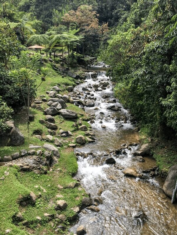 Hiking in Parque Salado Ecologico
CERRO DE LAS TRES CRUCES
 Begin organizing your dream Colombian getaway right away by using our Plan My Trip page!
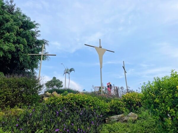
Should you not be able to spend an entire day hiking, a different route to explore is Cerro de Las Tres Cruces, which is located in the Belén barrio. Belén is enormous, and the trailhead is not easily reached by means of public transport. Therefore, for this one it is probably best to take a taxi or Uber to arrive at the start.
When compared to Cerro Bravo, this hike is quite easy, and within ten or fifteen minutes, you will start to see very impressive views of the city. On a clear day, you can see the vast majority of the Aburrá Valley and observe the airplanes land at the municipal downtown airport, EOH (Olaya Herrera Airport). If you go on a weekend, there will be many others on the trail with you. Along the way, you will see a variety of entrepreneurial Colombians selling water and fruit. At the summit, there is a tienda (store) with smoothies and also a gym with workout equipment.
Most people will opt to return down the same trail, but if you have a little extra time to spare and are feeling adventurous, you can take a separate way down the west side of the mountain. From the very top of the hill, just beyond where the outdoor exercise equipment is located, you will see a trail that heads in the opposite direction from where you ascended. To get back to civilization on this path takes about an hour and a half; however, it is a nice variation because it winds into a different Belén barrio. There are a number of restaurants with lookout points along this alternative path. The path soon turns into a road that winds its way back into the city.
PARQUE ARVÍ
This is a nature preserve and archaeological site found outside of Medellín in the Aburrá Valley.
Covering over 16,000 hectares/39,537 acres, Parque Arví is known for its wildflowers, nature tours, and over 54 miles/87 km of hiking trails.
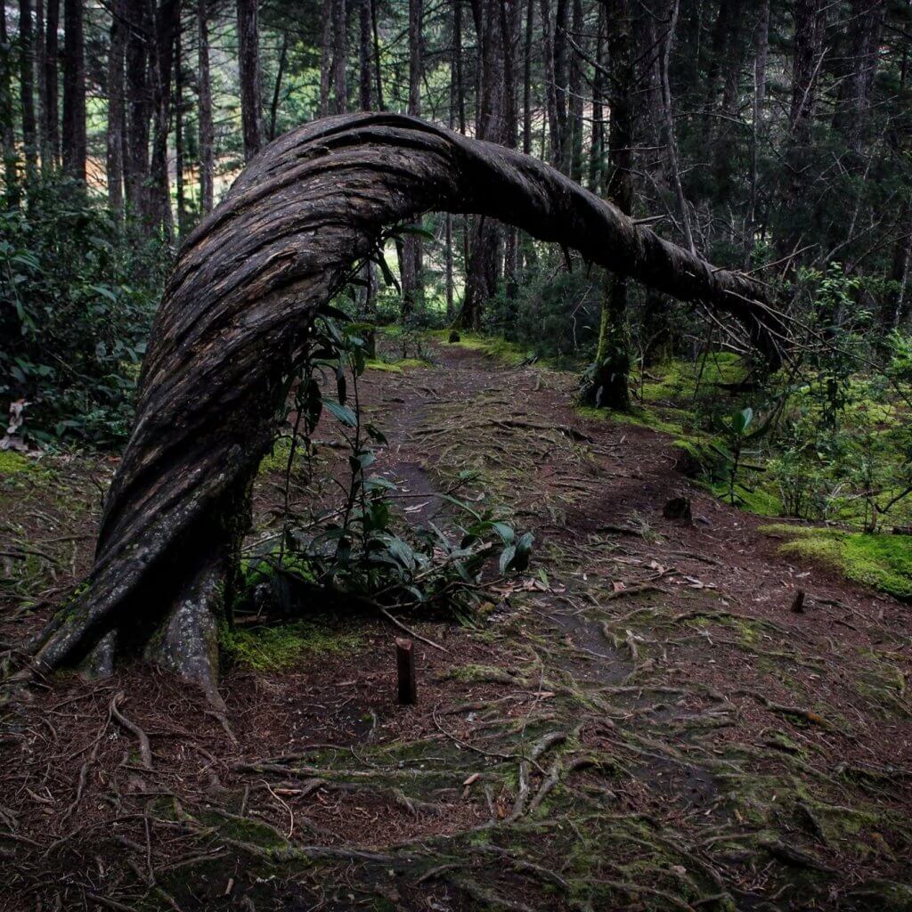 Twisted tree in Parque Arví
The main attraction of Parque Arví is its 12 well-defined and maintained nature trails, affording abundant hiking opportunities on the doorstep of Medellín. Within the park rest sections of prehistoric ruins, including waterworks pathways, platforms, gardens, trenches, and roads. The pre-hispanic trail, or the Camino Cienza de Leon, is assumed to be over 1,500 years old. Offering spectacular views of Medellín and the surrounding Aburrá Valley, the high terrain running through the western part of Parque Arví is one of the most preserved trails leading to the Laguna de Guarne and Seca Lake region.
Parque Arví also hosts an outdoor regional food market and an Ecological Hotel. Guests to the park can enjoy nature tours, cycling, outdoor adventure sports, and guided hikes such as a two-hour butterfly and flora tour, known as the Porton de Guabayo, that identifies native butterflies in the park. Other tours include nightly guided hikes showcasing the regional cultural exchange through music and campfire discussions on Medellín’s history and folklore.
To go on park trails, you have to go on a guided tour. The park closes at 6:00 pm, and the last tour leaves at 4:30PM. To get to Parque Arví, just take the metro to Acevedo station, then transfer to the Metro Cable gondola for a ride up and over the hills and into the park.
JARDÍN
Jardín is a beautiful, aesthetic, colonial pueblo located in the department of Antioquia, about 4 hours from Medellín. Thanks to its lush vegetation, topographic location, and plenty of freshwater sources, Jardín is one of the best hiking areas in Colombia.
Jardín and the surrounding pueblos offer a tremendous variety of day hikes of various intensity levels.
Here is a small selection of them:
- Cueva del Esplendor
The town of Jardín near Medellín draws visitors with its picture-perfect streets painted in a riot of vibrant shades, but there is more to do here than sip coffee in the shady plaza. For a more active day out, you will want to head out to the town’s most popular hiking destination, the cavern known as Cueva del Esplendor. This is a fabulous waterfall hike of 23 kms/14 miles round trip of moderate intensity.
This long day hike begins on the western edge of Jardín and climbs into the patchwork of rolling hills and farmland that defines Colombia’s coffee-growing region in the Andean foothills. Muddy trails wind past rushing streams and creep through dense forest, so you will need sturdy hiking boots and some steady footwork. Eagle-eyed hikers may spot rare bird species such as the orange-breasted tanager finch flitting in the canopy above.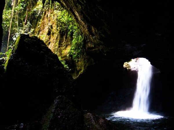
Once you arrive at the cavern, it immediately becomes clear why this fissure in the rock is known as the Cave of Splendour. As your eyes become accustomed to the darkness, you will be spellbound by the sight of a roaring blast of foaming water bursting from the roof into a pool below.
The cave sits on private land, so you are required to pay a small entry fee, with a limited number of visitors allowed each day.
- Cristo Rey Trail
This hike is a beautiful one-day excursion from the delightful little pueblo of Támesis, around three hours south of Medellín.
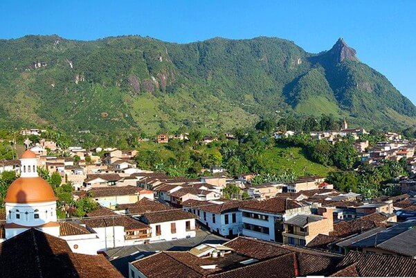
High on a hill overlooking the pueblo stands a Rio-style statue of Jesus with his arms outstretched over the majestic Cauca River valley beyond.
There is an excellent 16 kms/10 mile round trip hike up to this viewpoint and back into the pueblo.
As the first half of the hike is completely uphill, this is not one for the unfit but the rewards are so worth it.
Trekkers will come across ancient indigenous petroglyphs, fresh trout for lunch, the possibility of caving along the way and to top it all off, one of the most spectacular views in Colombia over the distant Cauca River.
- Cerro Tusa
As one of the best hikes near Medellín, the impressive Cerro Tusa hike offers a challenging adventure for locals and visitors alike. A short distance from Venecia, the Cerro Tusa natural pyramid towers above the landscape and attracts outdoor enthusiasts from all over.
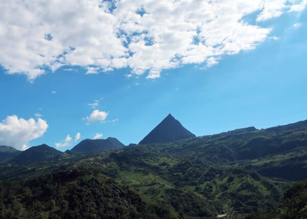
Cerro Tusa is a spectacular sight, towering high above the Antioquia countryside. The trail has been revamped with switchbacks, clay steps, and ropes leading steeply up to the summit. There are two wooden platforms with spectacular views of the mountains. With a local guide, visitors gain insights into Indigenous culture and traditions as well.
Before planning your trip, it is important to know that Cerro Tusa is not for the faint of heart. If you are not much of a hiker or are afraid of heights, you might not enjoy this tough and steep hike. Cerro Tusa’s hiking trail demands a level of fitness to gain over 600 metres/1,969 feet in elevation, most of which is in the final kilometre up to the summit.
Adding to the adventure, Cerro Tusa sits at 1,423 metres/4,669 feet above sea level which can cause challenges for visitors from lower altitudes. Be prepared for steep hiking with the use of ropes to reach the summit on this demanding day hike.
If you are up for the challenge, you will not regret this opportunity to undertake this hike.
Like to create or customize a fantastico package tour of Colombia? Use our Plan My Trip page to start planning your dream Colombian vacation now!