
MAJOR RIVERS OF COLOMBIA
 We work with and recommend booking flights with www.kiwi.com
Colombia is a mega-diverse country in culture, ecosystems, and biodiversity, and all are supported by an extremely rich network of rivers and watersheds.
Several powerful river basins cut through and delineate the borders of the country. The headwaters for hundreds of rivers are found in the high-altitude glaciers, lakes, páramos, and cloud forests of the Andes and Sierra Nevada de Santa Marta Mountain Ranges, while many others have their sources within the Chocó and Amazon tropical lowland forests.
These rivers flow through a vast range of ecosystems and biodiversity hotspots on their way to Colombia’s Atlantic and Pacific Coasts, as well as towards the massive Amazon River Basin. Transboundary rivers, such as the Amazon and Orinoco Rivers, also flow through the awe-inspiring tropical forests of southeastern Colombia.
Along the impressive network of Colombian waterways are eighty-seven recognized Indigenous ethnic groups, with distinct world views and interpretations of the origins, importance, and damage being done to their sacred rivers. While there exists a tremendous diversity in beliefs, language, ecosystems, and modern circumstances between Indigenous ethnic groups in Colombia and, of course, among traditional cultures around the world, they share a common belief that rivers are vital sources of life, balance, and connectivity.
To many Indigenous peoples, rivers from their sources to their outlets are Mother Earth’s lifeblood. To obstruct, contaminate, deviate, overfish, deforest, and otherwise degrade this life-giving and sustaining network is a natural crime.
Major Rivers Of Colombia
| Rank | Major Rivers of Colombia | Total Length |
| 1 | Amazon | 4,345 miles/6.993 kms (shared with Peru and Brazil) |
| 2 | Caquetá (Japura) | 1,750 miles/2,816 kms (shared with Brazil) |
| 3 | Negro | 1,386 miles/2,231 kms (shared with Brazil and Venezuela) |
| 4 | Orinoco | 1,330 miles/2,140 kms (shared with Venezuela) |
| 5 | Putumayo | 1,000 miles/1,609 kms (shared with Peru and Brazil) |
| 6 | Magdalena | 950 miles/1,529 kms |
| 7 | Guaviare | 930 miles/1,511 kms (shared with Venezuela) |
| 8 | Arauca | 652 miles/1,049 kms (shared with Venezuela) |
| 9 | Cauca | 600 miles/966 kms |
| 10 | Meta | 500 miles/805 kms (shared with Venezuela) |
AMAZON RIVER
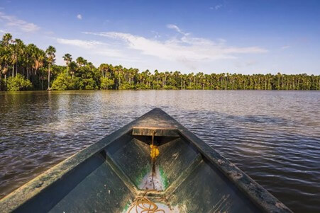
The Amazon River is the largest river in South America and the second largest river in the world. The river spans roughly one-third of the South American continent and is fed by more than 1,000 sources, including tributaries and smaller rivers that flow into the Amazon. Its watershed includes areas of Brazil, Peru, Ecuador, Colombia, Venezuela, and Bolivia. The mouth of the Amazon River is in northern Brazil, and the farthest points of the mouth are roughly 220 miles apart from each other. The Amazon is a freshwater river, and it is responsible for approximately one-fifth of the amount of freshwater entering oceans globally.
Many South American indigenous peoples and cultures lived along the Amazon River before South America was colonized by the conquistadors of the Spanish Empire in the 16th century. However, for Europeans, the Amazon River was discovered by the conquistador Francisco de Orellana in 1541. It is said that de Orellana named the river the Amazon on account of the indigenous warrior women he saw there, which reminded him of the Amazons, female warriors and hunters of Greek mythology.
While Amazon increasingly became the target of commercial conquerors, rubber barons, and religious fanatics, true exploration continued in the guise of the scientific explorers who came in the 18th century and onwards. The scientific exploration of the Amazon, of course, continues today, albeit with far more technological resources available to modern-day explorers. The Amazon still has plenty of secrets to share with the world, some of which may already be known by its indigenous inhabitants; however, there are likely many others waiting to be discovered.
THE CAQUETÁ RIVER
The Caquetá river flows eastwards through Southern Colombia for about 2,816 km/1,750 miles from its source in Páramo de las Papas in the Colombian Massif, to its junction with the Amazon River.
 Small waterfall on the Caquetá River
The Caquetá River, which is also known as the Japurá River, is a massive waterway found in Colombia. More specifically, the Amazon Rainforest harbours this essential artery as it provides for the ecosystems that depend on it.
Regarding human use, the Caqueta has been used for transportation and sustenance for millennia. It has witnessed conflicts since the 16th-century arrival of the Spanish Conquistadors and the indigenous empires of the continent.
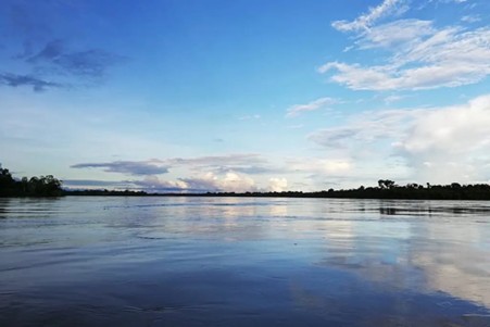 Japurá or Caquetá River
Today, the region’s economy primarily revolves around fishing, agriculture, and forestry. Fishing, both commercial and subsistence, is a mainstay for the local communities. The River teems with a variety of fish species, serving as a crucial source of protein for the local population. In the fertile floodplains, agriculture thrives, with crops such as cassava, bananas, and other tropical fruits being cultivated.
THE PUTUMAYO RIVER
Begins its course in Nudo de los Pastos and flows 1,609 km/1,000 miles eastwards. It is a classic border river separating Colombia from Peru at some points and from Ecuador at others. The Putumayo is the Amazon’s main tributary in Colombia, starting in Nudo de los Pastos and flowing all those miles east.
 Begin organizing your dream Colombian getaway right away by using our Plan My Trip page!
The great thing about the Putumayo is that it’s a major transportation artery, navigable for almost its entire length. This fact was discovered by French explorer Jules Crevaux, who sailed it day and night for 1,300 km/800 miles on a steamer in the late 19th century and never once hit any rapids. The Putumayo was at the heart of the region’s rubber boom, and in the time of the conquest, an escape route for many indigenous people fleeing from slavery.
The Putumayo basin is sparsely populated, and most development is in the Andean headwaters. The foothill region and adjacent lowlands have been extensively deforested for agriculture. The most developed area is centred on the Orito oil fields, and the trans Andino pipeline transports crude oil from the fields to Tumaco on the Colombian coast.
THE MAGDALENA RIVER
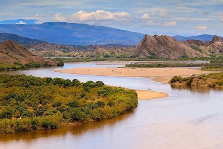 Magdalena River
The majestic Magdalena River is one of Colombia’s treasures, a connector of cities, a wildlife haven and a vital player in the rich history of the country. This is the most important commercial waterway in Colombia, as well as a source of electric power and natural beauty.
The Magdalena River originates in the southern region of the country, near the Magdalena Lake in Páramo de las Papas of the Colombian Massif. The Magdalena River flows northwards through Colombian territory to the Caribbean Sea at Bocas de Ceniza. Its total length is 1,558 km/968 miles, navigable without interruption for about 1,300 km/808 miles, and it is the longest inter-Andean river in South America. The Magdalena basin has an area of 256,622 square kilometres/99,098 square miles, with about 500 tributary rivers and more than 5,000 streams draining into it.
The importance of the Magdalena River dates back to before colonial times, thanks to its advantageous flow from the heart of Colombia to the Caribbean Sea. In the 16th. century, Spanish conquistadors used the river as a highway to transport goods from Europe to inland Colombia and back. Along its course, they founded several pueblos and built dozens of ports that later became the scene of the country’s fight for independence.
The natural resources from the river are still invaluable and have helped boost development in many communities throughout history. Since then, the grandness of the river has inspired artists and writers, including the prominent Colombian writer Gabriel García Marquez. Improved navigability will create newer opportunities for riverbank pueblos, especially those closer to the Caribbean Sea.
THE GUAVIARE RIVER
With a length of approximately 1,497 km/930 miles, it is formed at the junction of the Ariari and Guayabero Rivers in the Cordillera Oriental in the western part of the Meta department.
It meanders east-north-eastward between the Vichada and Guainia departments until it joins the Orinoco River.
 Caño Cristales
Caño Cristales is Colombia’s most colourful river, also known as the River of Five Colours or the Liquid Rainbow. This is due to a curious red plant, Macarenia clavigera, which lines the riverbed and blooms from July to November.
The river is around 100 km/62 miles long and is located in Meta. The strange thing is, even though the river is home to eight primates, 43 reptile species and 10 types of amphibian (not to mention the 420 bird species that line its banks) it does not contain a single fish, because it has no nutrients for them, a fact that makes the water extremely clear.
THE CAUCA RIVER

The river in the Colombian Massif near Laguna del Buey flows northwards between the Western and Central cordilleras to its mouth at the Magdalena River in Bolívar department. With a length of 966 km/600 miles and a navigable area of around 620 km/385 miles, the Cauca River is the second longest in the country.
The waterway comprises three distinct stretches, the first of which defines the rich agricultural area of the Cauca Valley, which is readily navigable. From here, the river then descends into the largely impassable Cauca Canyon through the departments of Caldas, Risaralda and Antioquia until reaching the town of Valdivia. Its fertile valley merges into a vast swamp before joining the Magdalena basin. The third stretch, a desolate region until the development of a coffee-based economy in the early twentieth century.
During the colonial period, the upper valley’s cattle haciendas and tobacco production supplemented the gold mining activities of the region’s economy, products augmented by sugar and coffee production in the late nineteenth century. The region around Cali contains one of Colombia’s most diversified and dynamic economic centres.
THE META RIVER
The Meta is the main river of the Colombian Eastern Plains (Llanos Orientales) with a total length of 805 km/500 miles. It starts high up in the Andes mountains in Colombia. It forms where smaller rivers like the Humea, Guatiquía and Guayuriba join together. From there, it flows east across wide, flat plains known as the Llanos Orientales. The river follows a natural crack in the Earth called the Meta Fault.

In the Colombian Llanos Orientales, or Eastern Plains, the Meta River is the most important and is navigable for the most part. The river is important for commerce in the region. Cravo Sur, Casanare, Cusiana, Upia and Manacacias are some of its tributary rivers.
ORINOCO RIVER
The Orinoco is one of the longest rivers in South America at 1,497 miles/2,410 km, and one of the largest river systems in the world. Its vast drainage basin, sometimes called the Orinoquia (especially in Colombia), covers over 340,000 square miles/880,000 square km, the vast portion of which is in Venezuela, with the remainder in Colombia and Brazil.
The Orinoco River region is home to over one thousand species of birds, including the beautiful scarlet ibis, the bellbird, the umbrella bird, flamingos and colourful parrots. The great variety of fish includes electric eels, catfish often weighing over two hundred pounds/ninety-one kilos and the carnivorous piranha.
The Amazon River Dolphin, which can grow up to nine feet/nearly three metres in length, boa constrictors and caimans also inhabit the Orinoco River system. The Orinoco crocodile, reaching more than 20 feet/6 m, is one of the rarest reptiles in the world, with fewer than 250 specimens known to exist; its present-day range is restricted to the Orinoco River Basin.
The river is navigable for most of its length, permitting large river steamers to carry cargo as far as Puerto Ayacucho and the Atures Rapids, a distance of 700 miles/1,127 km from the delta.
THE ATRATO RIVER
The Atrato River, at 700 km/435 miles in length, holds the highest volume of water of any river in Colombia. It originates in the Cordillera Occidental and flows into the Gulf of Urabá in the Caribbean Sea.

The Atrato River is one of the most important navigable rivers in Colombia. Originating near the town of Quibdó, this powerful river supports life throughout the department of Chocó and eventually flows into the Caribbean Sea.
Protecting the tropical forests near the origin of this river is critical for safeguarding the ecosystem. These tropical rainforests are some of the most biodiverse in the world, with numerous wildlife species, such as the Baudo Oropendola (Psarocolius cassini), existing nowhere else.
Navigable by small boats as far upstream as Quibdó, the lower Atrato has been considered a feasible route for a trans-isthmian canal.
Like to create or customize a fantastico package tour of Colombia? Use our Plan My Trip page to start planning your dream Colombian vacation now!